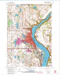
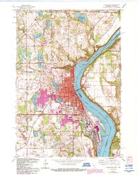
1967 Map of Stillwater
USGS Topo · Published 1987About this map
Stillwater dominates this riverfront survey, centered on the historic river landing where the St Croix River meets the expanding urban footprint of the late 1960s. The map captures a detailed view of the community's civic infrastructure, from the Courthouse and Washington Sch to the prominent Minnesota State Prison located just south of Oak Park Heights. The landscape is a mix of industrial river use and residential growth, with purple photorevisions from 1977 highlighting the suburban spread toward Lake McKusick and Lily Lake.
Find a feature on this map
55 named features on this map. Tap any name to fly to it.
Don’t see what you’re looking for? This feature index may not catch every label — zoom into the map to look around manually.
Map Details
Editions of this 1967 Stillwater Map
5 editions found
Other maps of this area

1946 · Hudson
USGS Topo · 1:62,500

1946 · River Falls
USGS Topo · 1:62,500

1948 · New Richmond
USGS Topo · 1:62,500

1948 · Stillwater
USGS Topo · 1:62,500

1949 · New Richmond
USGS Topo · 1:62,500

1949 · River Falls
USGS Topo · 1:62,500

1949 · Hudson
USGS Topo · 1:62,500

1949 · Stillwater
USGS Topo · 1:62,500

1949 · Lake Elmo
USGS Topo · 1:24,000

1949 · Hudson
USGS Topo · 1:24,000