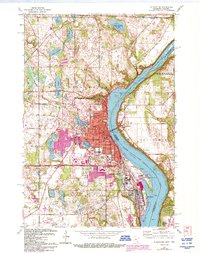
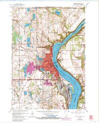
1967 Map of Stillwater
USGS Topo · Published 1993About this map
The St Croix River corridor is the centerpiece of this 1967 survey, capturing Stillwater and its neighboring communities during a period of significant late-20th-century development. While the river defines the border between Washington and St Croix Counties, the map reveals the intricate residential and industrial layout of Bayport, Oak Park Heights, and Houlton. A prominent landmark is the massive Minnesota State Prison complex south of the city, standing in contrast to the numerous recreational and civic features like the Drive-in Theater and Lily Lake.
Find a feature on this map
51 named features on this map. Tap any name to fly to it.
Don’t see what you’re looking for? This feature index may not catch every label — zoom into the map to look around manually.
Map Details
Editions of this 1967 Stillwater Map
5 editions found
Other maps of this area

1946 · Hudson
USGS Topo · 1:62,500

1946 · River Falls
USGS Topo · 1:62,500

1948 · New Richmond
USGS Topo · 1:62,500

1948 · Stillwater
USGS Topo · 1:62,500

1949 · New Richmond
USGS Topo · 1:62,500

1949 · River Falls
USGS Topo · 1:62,500

1949 · Hudson
USGS Topo · 1:62,500

1949 · Stillwater
USGS Topo · 1:62,500

1949 · Lake Elmo
USGS Topo · 1:24,000

1949 · Hudson
USGS Topo · 1:24,000