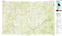
1985 Map of Sullivan
USGS Topo · Published 1988About this map
Sullivan, Cuba, and Owensville serve as central hubs in this mid-1980s landscape, where the Burlington Northern railroad and Interstate 44 corridor facilitate movement through the foothills of the Ozarks. The region is defined by a dense network of watercourses, including the winding Bourbeuse River and Gasconade River, which shaped the early settlement patterns of the surrounding townships like Boulware and Canaan.
Find a feature on this map
128 named features on this map. Tap any name to fly to it.
Don’t see what you’re looking for? This feature index may not catch every label — zoom into the map to look around manually.
Map Details
Editions of this 1985 Sullivan Map
3 editions found
Other maps of this area

1886 · Jefferson City
USGS Topo · 1:125,000

1888 · Tuscumbia
USGS Topo · 1:125,000

1890 · Hermann
USGS Topo · 1:125,000

1890 · Fulton
USGS Topo · 1:125,000

1894 · Tuscumbia
USGS Topo · 1:125,000

1894 · Jefferson City
USGS Topo · 1:125,000

1901 · De Soto
USGS Topo · 1:125,000

1903 · O'Fallon
USGS Topo · 1:125,000

1903 · Sullivan
USGS Topo · 1:125,000

1906 · Potosi
USGS Topo · 1:62,500