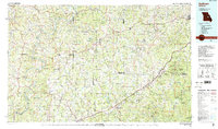
1985 Map of Sullivan
USGS Topo · Published 1988About this map
The Gasconade River and Bourbeuse River carve deep paths through the Ozark Plateau in this mid-1980s landscape, where small agricultural hubs and conservation lands define the region. Towns like Sullivan, Owensville, and St James anchor a network of rural routes and the Burlington Northern railroad, reflecting a period of steady growth and outdoor recreation. The eastern portion is marked by the expansive Meramec State Forest and Onondaga Cave State Park, highlighting the importance of the limestone geology and river systems to the local economy.
Find a feature on this map
104 named features on this map. Tap any name to fly to it.
Don’t see what you’re looking for? This feature index may not catch every label — zoom into the map to look around manually.
Map Details
Editions of this 1985 Sullivan Map
3 editions found
Other maps of this area

1886 · Jefferson City
USGS Topo · 1:125,000

1888 · Tuscumbia
USGS Topo · 1:125,000

1890 · Hermann
USGS Topo · 1:125,000

1890 · Fulton
USGS Topo · 1:125,000

1894 · Tuscumbia
USGS Topo · 1:125,000

1894 · Jefferson City
USGS Topo · 1:125,000

1901 · De Soto
USGS Topo · 1:125,000

1903 · O'Fallon
USGS Topo · 1:125,000

1903 · Sullivan
USGS Topo · 1:125,000

1906 · Potosi
USGS Topo · 1:62,500