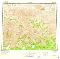
1956 Map of Survey Pass
USGS Topo · Published 1959About this map
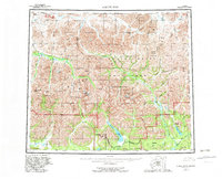
Mount Igikpak anchors this high-latitude survey of the central Brooks Range, where the continental divide separates north-flowing waters like the Killik River and Nigu River from the southern drainages. The landscape is a network of named peaks and high passes, including Survey Pass and Kutuk Pass, which traditionally served as vital transit corridors through the Endicott Mountains and Schwatka Mountains. A notable human imprint appears in the northeast at the Naval Pet Res No 4, indicating mid-century strategic interests in the Arctic.
Find a feature on this map
90 named features on this map. Tap any name to fly to it.
Don’t see what you’re looking for? This feature index may not catch every label — zoom into the map to look around manually.
Map Details
Editions of this 1956 Survey Pass Map
7 editions found

Other maps of this area

1951 · Shungnak
USGS Topo · 1:250,000

1951 · Hughes
USGS Topo · 1:250,000

1951 · Bettles
USGS Topo · 1:250,000

1951 · Survey Pass
USGS Topo · 1:250,000

1951 · Chandler Lake
USGS Topo · 1:250,000

1951 · Howard Pass
USGS Topo · 1:250,000

1951 · Ambler River
USGS Topo · 1:250,000

1951 · Killik River
USGS Topo · 1:250,000

1951 · Wiseman
USGS Topo · 1:250,000

1955 · Shungnak
USGS Topo · 1:250,000