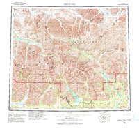
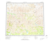
1956 Map of Survey Pass
USGS Topo · Published 1994About this map
Mount Igikpak anchors the dramatic landscape of the central Brooks Range, where the crest of the Continental Divide separates the north-flowing Killik River from the waters of the south. This mid-century survey documents the expansive wilderness of the Schwatka Mountains and Endicott Mountains before the formal establishment of modern preservation boundaries. The terrain is defined by high-altitude crossings such as Survey Pass and Kutuk Pass, which served as critical navigation points through the interior long before the designation of Gates of the Arctic National Park. Drainage patterns are meticulously mapped, showing the headwaters of the Alatna River and Noatak River, as well as prominent summits like the Arrigetch Peaks and Mount Hal Waugh. Scattered Cabins and portages hint at the sparse human footprint in this subarctic environment, dominated by significant water bodies like Oyukak Lake and Kakahula Lake.
Find a feature on this map
70 named features on this map. Tap any name to fly to it.
Don’t see what you’re looking for? This feature index may not catch every label — zoom into the map to look around manually.
Map Details
Editions of this 1956 Survey Pass Map
7 editions found

Other maps of this area

1951 · Shungnak
USGS Topo · 1:250,000

1951 · Hughes
USGS Topo · 1:250,000

1951 · Bettles
USGS Topo · 1:250,000

1951 · Survey Pass
USGS Topo · 1:250,000

1951 · Chandler Lake
USGS Topo · 1:250,000

1951 · Howard Pass
USGS Topo · 1:250,000

1951 · Ambler River
USGS Topo · 1:250,000

1951 · Killik River
USGS Topo · 1:250,000

1951 · Wiseman
USGS Topo · 1:250,000

1955 · Shungnak
USGS Topo · 1:250,000