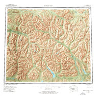
1956 Map of Survey Pass
USGS Topo · Published 1974About this map
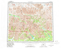
The Continental Divide carves through the heart of the Brooks Range in this mid-century survey, separating the headwaters of several major arctic river systems. To the north, the Killik River and Nigu River flow toward the Beaufort Sea, while the southern slopes are dominated by the Alatna River and the Unakserak River. This wilderness landscape is defined by its high-altitude landmarks, including the towering Mount Igikpak and the distinctive Arrigetch Peaks. The presence of Naval Pet Res No 4 in the northwest corner highlights the federal interest in resource exploration during this era. While formal settlements are absent, a single Cabin label and the Helpmejack Hills area provide rare evidence of human activity in this remote region. The map also documents the Kateel River Meridian boundary, marking a primary survey line through the Endicott Mountains and Schwatka Mountains.
Find a feature on this map
94 named features on this map. Tap any name to fly to it.
Don’t see what you’re looking for? This feature index may not catch every label — zoom into the map to look around manually.
Map Details
Editions of this 1956 Survey Pass Map
7 editions found

Other maps of this area

1951 · Shungnak
USGS Topo · 1:250,000

1951 · Hughes
USGS Topo · 1:250,000

1951 · Bettles
USGS Topo · 1:250,000

1951 · Survey Pass
USGS Topo · 1:250,000

1951 · Chandler Lake
USGS Topo · 1:250,000

1951 · Howard Pass
USGS Topo · 1:250,000

1951 · Ambler River
USGS Topo · 1:250,000

1951 · Killik River
USGS Topo · 1:250,000

1951 · Wiseman
USGS Topo · 1:250,000

1955 · Shungnak
USGS Topo · 1:250,000