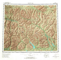
1956 Map of Survey Pass
USGS Topo · Published 1967About this map
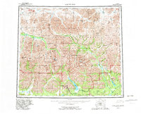
Mount Igikpak stands as a focal point in this 1950s survey of the northern Alaskan interior, where the Schwatka Mountains meet the Endicott Mountains within the greater Brooks Range. The landscape is defined by the Continental Divide, which separates the headwaters of the Alatna River and the Kutuk River from northward-flowing streams like the Nigu River. Human presence is sparse, marked only by an isolated Cabin and the Alatna Portage, a historical travel route connecting river systems. The inclusion of the Naval Pet Res No 4 boundary in the northwest corner reflects mid-century strategic interest in the region's resources. The map also captures significant drainage patterns around Takahula Lake and Iniakuk Lake, providing a clear view of the high-altitude topography at Survey Pass and Akabluak Pass before modern development reached these wilderness areas.
Find a feature on this map
86 named features on this map. Tap any name to fly to it.
Don’t see what you’re looking for? This feature index may not catch every label — zoom into the map to look around manually.
Map Details
Editions of this 1956 Survey Pass Map
7 editions found

Other maps of this area

1951 · Shungnak
USGS Topo · 1:250,000

1951 · Hughes
USGS Topo · 1:250,000

1951 · Bettles
USGS Topo · 1:250,000

1951 · Survey Pass
USGS Topo · 1:250,000

1951 · Chandler Lake
USGS Topo · 1:250,000

1951 · Howard Pass
USGS Topo · 1:250,000

1951 · Ambler River
USGS Topo · 1:250,000

1951 · Killik River
USGS Topo · 1:250,000

1951 · Wiseman
USGS Topo · 1:250,000

1955 · Shungnak
USGS Topo · 1:250,000