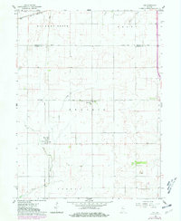
1961 Map of Tab
USGS Topo · Published 1981About this map
The settlement of Tab serves as a focal point for this agrarian landscape on the border of Benton and Warren counties, marked by the presence of large grain Elevators along the Conrail line. The map captures a transition in regional transport as the Norfolk and Western tracks cross the northern section, while local life centers around the Township Sch and the community cluster at Locust Grove Ch and the adjacent Locust Grove Cem.
Find a feature on this map
21 named features on this map. Tap any name to fly to it.
Don’t see what you’re looking for? This feature index may not catch every label — zoom into the map to look around manually.
Map Details
Editions of this 1961 Tab Map
4 editions found
Other maps of this area

1933 · Hoopeston
USGS Topo · 1:48,000

1938 · Milford
USGS Topo · 1:48,000

1938 · Hoopeston
USGS Topo · 1:62,500

1944 · Milford
USGS Topo · 1:62,500

1953 · Danville
USGS Topo · 1:250,000

1955 · Danville
USGS Topo · 1:250,000

1956 · Danville
USGS Topo · 1:250,000

1961 · Tab
USGS Topo · 1:24,000

1961 · Pine Village
USGS Topo · 1:24,000

1961 · West Lebanon
USGS Topo · 1:24,000