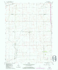
1961 Map of Tab
USGS Topo · Published 1986About this map
Tab stands as a rail-centered community in the heart of Warren County, where the north-south Conrail line intersects with the east-west Norfolk and Western tracks. The prominence of grain elevators at the rail junction reflects the agricultural industry of the surrounding prairie. This area, largely settled along the divide between the Hickory Grove and Prairie townships, maintains its traditional social hubs at Locust Grove, featuring the Locust Grove Ch, a Cem, and the nearby Township Sch.
Find a feature on this map
22 named features on this map. Tap any name to fly to it.
Don’t see what you’re looking for? This feature index may not catch every label — zoom into the map to look around manually.
Map Details
Editions of this 1961 Tab Map
4 editions found
Other maps of this area

1933 · Hoopeston
USGS Topo · 1:48,000

1938 · Milford
USGS Topo · 1:48,000

1938 · Hoopeston
USGS Topo · 1:62,500

1944 · Milford
USGS Topo · 1:62,500

1953 · Danville
USGS Topo · 1:250,000

1955 · Danville
USGS Topo · 1:250,000

1956 · Danville
USGS Topo · 1:250,000

1961 · Tab
USGS Topo · 1:24,000

1961 · Pine Village
USGS Topo · 1:24,000

1961 · West Lebanon
USGS Topo · 1:24,000