
1954 Map of Talkeetna B-3
USGS Topo · Published 1962About this map
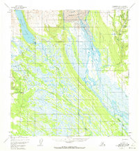
Chelatna Lake and the massive glacial system of the Kahiltna Glacier dominate this mid-century Alaskan landscape. The drainage patterns of the Kahiltna River and its numerous tributaries, such as Cache Creek and Mills Creek, suggest a region defined by its hydrography and seasonal changes. Human presence is concentrated at Chelatna Lodge and the small settlement of Collinsville, which is supported by a nearby Airstrip. A Tractor Trail provides a critical overland link through the wet lowlands, connecting remote outposts where few established roads exist. The presence of features like Hansen Bar and various named creeks such as Wetbutte Creek and Home Creek reflects the nomenclature of early aviation and prospecting, capturing a moment when access to the interior was dependent on light aircraft and specialized ground transport before modern infrastructure reached these basins.
Find a feature on this map
25 named features on this map. Tap any name to fly to it.
Don’t see what you’re looking for? This feature index may not catch every label — zoom into the map to look around manually.
Map Details
Editions of this 1954 Talkeetna B-3 Map
4 editions found
Other maps of this area

1950 · Talkeetna
USGS Topo · 1:250,000

1951 · Talkeetna
USGS Topo · 1:250,000

1954 · Talkeetna A-3
USGS Topo · 1:63,360

1954 · Talkeetna B-4
USGS Topo · 1:63,360

1954 · Talkeetna A-2
USGS Topo · 1:63,360

1954 · Talkeetna A-4
USGS Topo · 1:63,360

1954 · Talkeetna B-2
USGS Topo · 1:63,360

1958 · Talkeetna C-4
USGS Topo · 1:63,360

1958 · Talkeetna C-2
USGS Topo · 1:63,360

1958 · Talkeetna C-3
USGS Topo · 1:63,360