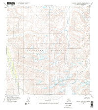
1951 Map of Talkeetna Mountains B-3
USGS Topo · Published 1968About this map
The Talkeetna Mountains define this high-altitude landscape in the early 1950s, characterized by a complex drainage network that feeds into major Alaskan waterways. The Talkeetna River flows prominently through the southwest, while the Black River and Kosina Creek carve deep paths through the central and eastern sections. This area represents an unsurveyed wilderness at the time of the 1951 field annotation, with land lines based on Bureau of Land Management predetermined locations rather than physical ground markers.
Find a feature on this map
10 named features on this map. Tap any name to fly to it.
Don’t see what you’re looking for? This feature index may not catch every label — zoom into the map to look around manually.
Map Details
Editions of this 1951 Talkeetna Mountains B-3 Map
4 editions found
Other maps of this area

1949 · Talkeetna Mountains A-4
USGS Topo · 1:63,360

1950 · Talkeetna Mountains
USGS Topo · 1:250,000

1950 · Talkeetna Mountains B-4
USGS Topo · 1:63,360

1951 · Talkeetna Mountains A-2
USGS Topo · 1:63,360

1951 · Talkeetna Mountains C-2
USGS Topo · 1:63,360

1951 · Talkeetna Mountains B-3
USGS Topo · 1:63,360

1951 · Talkeetna Mountains A-3
USGS Topo · 1:63,360

1951 · Talkeetna Mountains B-2
USGS Topo · 1:63,360

1951 · Talkeetna Mountains C-4
USGS Topo · 1:63,360

1951 · Talkeetna Mountains C-3
USGS Topo · 1:63,360