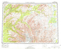
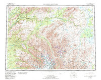
1954 Map of Talkeetna Mountains
USGS Topo · Published 1978About this map
The Alaska Railroad forms a vital transportation spine along the western edge of this vast interior landscape, connecting small whistle-stops and settlements like Curry, Gold Creek, and Sherman. This mid-century survey reveals the critical role of rail infrastructure before the widespread development of the modern highway system, with the Fairbanks Highway also appearing as a primary route. The map is dominated by the massive Talkeetna Mountains, where glacial systems like the Talkeetna Glacier and Chickaloon Glacier feed complex river networks.
Find a feature on this map
74 named features on this map. Tap any name to fly to it.
Don’t see what you’re looking for? This feature index may not catch every label — zoom into the map to look around manually.
Map Details
Editions of this 1954 Talkeetna Mountains Map
7 editions found

Other maps of this area

1948 · Anchorage D-3
USGS Topo · 1:63,360

1948 · Anchorage D-2
USGS Topo · 1:63,360

1948 · Anchorage D-4
USGS Topo · 1:63,360

1948 · Anchorage D-1
USGS Topo · 1:63,360

1949 · Tyonek
USGS Topo · 1:250,000

1949 · Talkeetna Mountains D-6
USGS Topo · 1:63,360

1949 · Anchorage D-5
USGS Topo · 1:63,360

1949 · Anchorage D-7
USGS Topo · 1:63,360

1949 · Talkeetna Mountains B-6
USGS Topo · 1:63,360

1949 · Talkeetna Mountains A-1
USGS Topo · 1:63,360