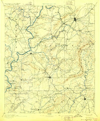
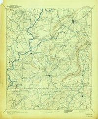
1892 Map of Talladega
USGS Topo · Published 1928About this map
Coosa River ferry crossings and early rail corridors define this late 19th-century portrait of central Alabama. Surveyed just decades after the Civil War, the landscape is marked by a complex network of river transits including Grissom Ferry, Glover Ferry, and Old Kymulga Ferry, reflecting a time before modern bridge infrastructure. The arrival of the East Tennessee Virginia and Georgia Railroad and the Columbus and Western Railroad began shifting trade toward emerging hubs like Sylacauga and Childersburg.
Find a feature on this map
131 named features on this map. Tap any name to fly to it.
Don’t see what you’re looking for? This feature index may not catch every label — zoom into the map to look around manually.
Map Details
Editions of this 1892 Talladega Map
6 editions found
Other maps of this area

1889 · Springville
USGS Topo · 1:125,000

1889 · Birmingham
USGS Topo · 1:125,000

1890 · Bessemer
USGS Topo · 1:125,000

1890 · Talladega
USGS Topo · 1:125,000

1891 · Clanton
USGS Topo · 1:125,000

1891 · Ashland
USGS Topo · 1:125,000

1892 · Birmingham
USGS Topo · 1:125,000

1892 · Springville
USGS Topo · 1:125,000

1892 · Talladega
USGS Topo · 1:125,000

1892 · Bessemer
USGS Topo · 1:125,000