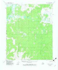
1956 Map of Tanana C-6
USGS Topo · Published 1982About this map
Tanana-Allakaket Winter Trail cuts through the northern reaches of this subarctic landscape, providing a vital overland connection during the 1950s. The geography is defined by an intricate network of drainage basins, most notably the Melozitna River and its numerous tributaries including Klatakhna Creek and Dagistakhna Creek. The terrain is marked by significant topographical shifts, such as Nukluket Pass, which serves as a natural gateway between the surrounding highlands and valley floors.
Find a feature on this map
10 named features on this map. Tap any name to fly to it.
Don’t see what you’re looking for? This feature index may not catch every label — zoom into the map to look around manually.
Map Details
Editions of this 1956 Tanana C-6 Map
3 editions found
Other maps of this area

1951 · Melozitna
USGS Topo · 1:250,000

1951 · Tanana
USGS Topo · 1:250,000

1952 · Melozitna D-1
USGS Topo · 1:63,360

1956 · Melozitna C-1
USGS Topo · 1:63,360

1956 · Melozitna B-1
USGS Topo · 1:63,360

1956 · Tanana B-5
USGS Topo · 1:63,360

1956 · Tanana B-6
USGS Topo · 1:63,360

1956 · Tanana C-6
USGS Topo · 1:63,360

1956 · Tanana D-6
USGS Topo · 1:63,360

1956 · Tanana C-5
USGS Topo · 1:63,360