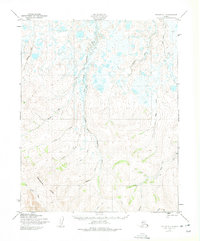
1950 Map of Teller D-1
USGS Topo · Published 1975About this map
The Continental Divide cuts across this Seward Peninsula landscape, separating the intricate drainage networks of the northern and southern slopes. Extensive water management systems are visible through several segments of a Ditch, indicating historical mining or hydraulic engineering efforts in the mid-20th century. The Serpentine River and its South Fork dominate the central topography, surrounded by a dense web of tributaries including Snowshoe Creek, Lincoln Creek, and Eldorado Creek.
Find a feature on this map
18 named features on this map. Tap any name to fly to it.
Don’t see what you’re looking for? This feature index may not catch every label — zoom into the map to look around manually.
Map Details
Editions of this 1950 Teller D-1 Map
4 editions found

Other maps of this area

1950 · Bendeleben C-6
USGS Topo · 1:63,360

1950 · Bendeleben D-6
USGS Topo · 1:63,360

1950 · Teller
USGS Topo · 1:250,000

1950 · Bendeleben
USGS Topo · 1:250,000

1950 · Shishmaref
USGS Topo · 1:250,000

1950 · Shishmaref A-1
USGS Topo · 1:63,360

1950 · Kotzebue A-6
USGS Topo · 1:63,360

1950 · Teller D-2
USGS Topo · 1:63,360

1950 · Shishmaref A-2
USGS Topo · 1:63,360

1950 · Teller C-2
USGS Topo · 1:63,360