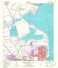
1954 Map of Texas City
USGS Topo · Published 1977About this map
Industrial growth and coastal expansion dominate the landscape of Texas City and La Marque during the mid-20th century. The map reveals a complex infrastructure of oil tanks, pipelines, and the Galveston County Industrial Water Reservoir serving the booming petrochemical sector. Along the waterfront, the massive Texas City Dike extends into the bay, protecting the Texas City Ship Channel and the busy turning basin. Residential growth is reflected in the numerous educational and religious sites, such as the Franklin Roosevelt Sch and St Marys Ch, centered around City Hall.
Find a feature on this map
47 named features on this map. Tap any name to fly to it.
Don’t see what you’re looking for? This feature index may not catch every label — zoom into the map to look around manually.
Map Details
Editions of this 1954 Texas City Map
3 editions found
Other maps of this area

1916 · Seabrook
USGS Topo · 1:24,000

1920 · Seabrook
USGS Topo · 1:31,680

1929 · Dickinson
USGS Topo · 1:24,000

1929 · Hitchcock
USGS Topo · 1:24,000

1929 · Virginia Point
USGS Topo · 1:24,000

1929 · Texas City
USGS Topo · 1:24,000

1930 · Galveston
USGS Topo · 1:24,000

1932 · Clifton By The Sea
USGS Topo · 1:31,680

1932 · Dickinson
USGS Topo · 1:31,680
1932 · Seabrook
USGS Topo · 1:31,680