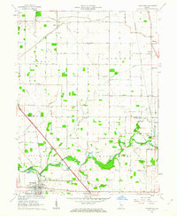
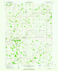
1962 Map of Thorntown
USGS Topo · Published 1963About this map
Thorntown serves as the primary hub in this early 1960s agricultural survey of Boone and Clinton Counties, where the New York Central railroad corridor shapes the local geography. The landscape is defined by the winding course of Sugar Creek and its tributaries, including Potato Creek and Goldsberry Creek. A notable historical landmark is the Old Indian Treaty Boundary, which cuts across the central townships of Perry and Jackson. This rural landscape is dotted with centers of early community life, such as Newhope Ch and Kinder Ch, alongside numerous family-named burial grounds like Gipson Cem and Maple Lawn Cem. The survey captures small crossroads settlements including Manson, Antioch, and Reagan before the significant expansion of modern infrastructure in central Indiana.
Find a feature on this map
35 named features on this map. Tap any name to fly to it.
Don’t see what you’re looking for? This feature index may not catch every label — zoom into the map to look around manually.
Map Details
Editions of this 1962 Thorntown Map
3 editions found
Other maps of this area

1953 · Lebanon
USGS Topo · 1:24,000

1953 · Danville
USGS Topo · 1:250,000

1955 · Danville
USGS Topo · 1:250,000

1956 · Danville
USGS Topo · 1:250,000

1961 · Michigantown
USGS Topo · 1:24,000

1961 · Mulberry
USGS Topo · 1:24,000

1961 · Mechanicsburg
USGS Topo · 1:24,000

1961 · Frankfort
USGS Topo · 1:24,000
1961 · Hazelrigg
USGS Topo · 1:24,000
1961 · Shannondale
USGS Topo · 1:24,000