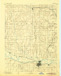
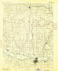
1894 Map of Topeka
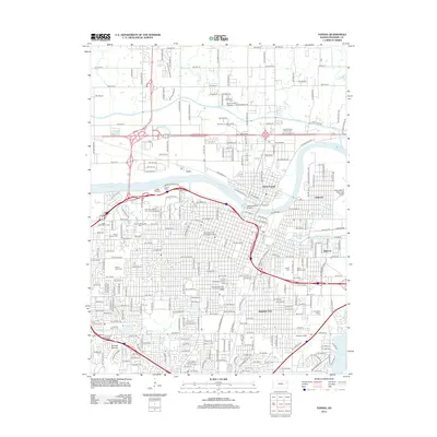
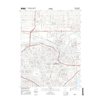
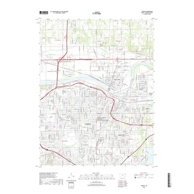
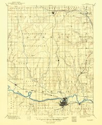
USGS Topo · Published 1925About this map
The Pottawatomie Indian Reservation occupies a massive portion of the central landscape, showing the Agency and several early settlements before significant 20th-century expansion. The state capital, Topeka, is depicted at a pivotal moment when it was already a major railroad hub, situated along the southern banks of the Kansas River. The map meticulously tracks the dense network of rail lines that defined the regional economy, including the Union Pacific Railroad following the river valley and the Chicago Kansas and Nebraska Railroad cutting north through Mayetta and Holton. Smaller agricultural centers like Silver Lake, Rossville, and Meriden are positioned at critical junctions, while numerous watercourses such as Big Soldier Creek and Muddy Creek reveal the natural drainage patterns that dictated the placement of early townships and roads.
Find a feature on this map
55 named features on this map. Tap any name to fly to it.
Don’t see what you’re looking for? This feature index may not catch every label — zoom into the map to look around manually.
Map Details
Editions of this 1894 Topeka Map
5 editions found

Historical Maps of Topeka Through Time
10 maps found