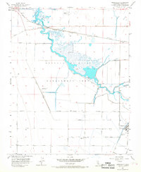
1956 Map of Tranquillity
USGS Topo · Published 1968About this map
Tranquillity and Mendota anchor this Central Valley landscape in the mid-1950s, a period defined by massive water management and the expansion of the Mendota Wildlife Management Area. The map reveals an intricate network of canals and dikes designed to control the Fresno Slough and James Bypass, including specialized features like Fish Rearing Ponds and various water control levees. These engineering efforts supported both the local agriculture and the protected wetlands that dominate the central portion of the quadrangle.
Find a feature on this map
32 named features on this map. Tap any name to fly to it.
Don’t see what you’re looking for? This feature index may not catch every label — zoom into the map to look around manually.
Map Details
Editions of this 1956 Tranquillity Map
3 editions found
Other maps of this area

1921 · Mendota
USGS Topo · 1:31,680

1922 · Tufts Ranch
USGS Topo · 1:31,680

1923 · Levis
USGS Topo · 1:31,680

1923 · Englebrecht Ranch
USGS Topo · 1:31,680

1923 · Firebaugh
USGS Topo · 1:31,680

1924 · Jamesan
USGS Topo · 1:31,680

1924 · Tranquillity
USGS Topo · 1:31,680

1924 · Gravelly Ford
USGS Topo · 1:31,680

1924 · Mendota
USGS Topo · 1:31,680

1925 · San Joaquin
USGS Topo · 1:31,680