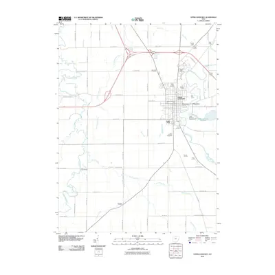
2010 Map of Upper Sandusky
USGS Topo · Published 2010About this map
The Sandusky River carves a winding path through this western Ohio landscape, anchoring the city of Upper Sandusky and its surrounding rural townships. The map reveals a dense concentration of commemorative and historical sites, including the Crawford Battle Ground and Indian Mill located just north of the city center. This area is notably rich in burial grounds that speak to the long-standing community roots here, from Tarhe Cemetery and Mission Cemetery to the Fort Ferree Cemetery and Saint Peters Cemetery.
Find a feature on this map
61 named features on this map. Tap any name to fly to it.
Don’t see what you’re looking for? This feature index may not catch every label — zoom into the map to look around manually.
Map Details
Editions of this 2010 Upper Sandusky Map
This is the sole edition of this map. No revisions or reprints were ever made.
Other maps of this area

1903 · Marion
USGS Topo · 1:62,500

1905 · Marion
USGS Topo · 1:62,500

1906 · Sycamore
USGS Topo · 1:62,500

1907 · Upper Sandusky
USGS Topo · 1:62,500

1915 · La Rue
USGS Topo · 1:62,500

1950 · Marion
USGS Topo · 1:250,000

1960 · Sycamore
USGS Topo · 1:24,000

1960 · Nevada
USGS Topo · 1:24,000
1960 · Morral
USGS Topo · 1:24,000

1960 · Upper Sandusky
USGS Topo · 1:24,000