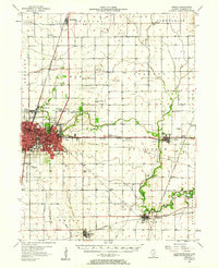
1957 Map of Urbana
USGS Topo · Published 1961About this map
The dual urban hubs of Urbana and Champaign anchor this mid-century survey of the Illinois prairie, showing the region just as the Interstate highway era began to reshape the outskirts. The map reveals a landscape defined by an extensive drainage network, including the Upper Salt Fork Drainage Ditch and Illinois Central Ditch, which converted rich wetlands into productive farmland. Beyond the city limits, numerous country schools like Locust Grove Sch and Fiedler Sch remain as evidence of a denser rural population before the consolidation of the late 20th century.
Find a feature on this map
87 named features on this map. Tap any name to fly to it.
Don’t see what you’re looking for? This feature index may not catch every label — zoom into the map to look around manually.
Map Details
Editions of this 1957 Urbana Map
2 editions found

Other maps of this area

1906 · Urbana
USGS Topo · 1:62,500

1907 · Mahomet
USGS Topo · 1:62,500

1924 · Paxton
USGS Topo · 1:62,500

1927 · Paxton
USGS Topo · 1:62,500

1928 · Gibson City
USGS Topo · 1:62,500

1931 · Fithian
USGS Topo · 1:48,000

1936 · Potomac
USGS Topo · 1:62,500

1943 · Fithian
USGS Topo · 1:62,500

1949 · Paxton
USGS Topo · 1:62,500

1950 · Tuscola
USGS Topo · 1:62,500