1961 Map of Urbana West
USGS Topo · Published 1962About this map
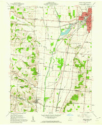
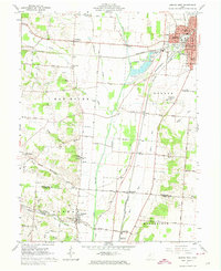
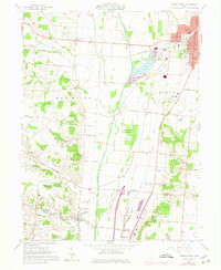
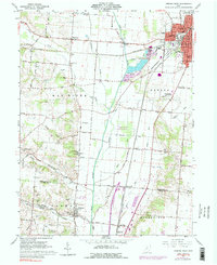
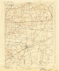
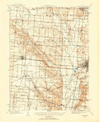
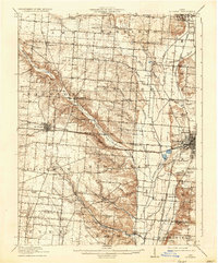
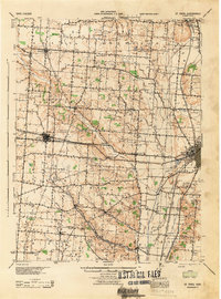
The Mad River valley serves as the central corridor for this 1961 survey, where the river's path is flanked by the intensive rail infrastructure of the Pennsylvania Railroad, Erie-Lackawanna Railroad, and New York Central Railroad. The city of Urbana dominates the northeastern corner, shown in detail with its street grid and institutions like Urbana Jr College and the County Home and Hospital. The surrounding rural landscape is defined by small settlements such as Westville, Bowlusville, and Tremont City, alongside numerous family-named burial grounds including Snider Cem, Shockey Cem, and Rector Cem. This era of the landscape is characterized by a mix of agricultural use and localized industrial activity, evidenced by the numerous Sand and Gravel Pits and borrow pits concentrated along the river and major roads like the Old Troy Pike.
Find a feature on this map
64 named features on this map. Tap any name to fly to it.
Don’t see what you’re looking for? This feature index may not catch every label — zoom into the map to look around manually.
Map Details
Editions of this 1961 Urbana West Map
4 editions found
Other maps of this area

1904 · Springfield
USGS Topo · 1:62,500

1906 · Springfield
USGS Topo · 1:62,500
1907 · South Charleston
USGS Topo · 1:62,500
1914 · St. Paris
USGS Topo · 1:62,500

1914 · Mechanicsburg
USGS Topo · 1:62,500

1916 · Mechanicsburg
USGS Topo · 1:62,500
1916 · St. Paris
USGS Topo · 1:62,500

1944 · Mechanicsburg
USGS Topo · 1:62,500
1944 · St. Paris
USGS Topo · 1:62,500

1947 · Columbus
USGS Topo · 1:250,000