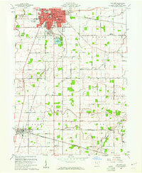
1960 Map of Van Wert
USGS Topo · Published 1961About this map
The city of Van Wert serves as the hub of this Northwest Ohio landscape, surrounded by the townships of Pleasant, Ridge, Liberty, and York. In the early 1960s, the area's layout is defined by a dense network of country roads and four major rail lines, including the Pennsylvania and the Erie Lackawanna. These railroads converge near the central business district, reflecting the region's importance as a mid-century transportation crossroads. Outside the city limits, the terrain is dotted with institutional landmarks such as the Marsh Foundation Sch and the Van Wert Airport.
Find a feature on this map
58 named features on this map. Tap any name to fly to it.
Don’t see what you’re looking for? This feature index may not catch every label — zoom into the map to look around manually.
Map Details
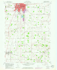
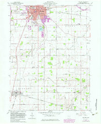
Editions of this 1960 Van Wert Map
3 editions found
Other maps of this area

1911 · Spencerville
USGS Topo · 1:62,500

1911 · Delphos
USGS Topo · 1:62,500

1914 · Celina
USGS Topo · 1:62,500

1914 · Van Wert
USGS Topo · 1:62,500

1944 · Delphos
USGS Topo · 1:62,500

1944 · Van Wert
USGS Topo · 1:62,500

1944 · Celina
USGS Topo · 1:62,500

1944 · Spencerville
USGS Topo · 1:62,500

1953 · Muncie
USGS Topo · 1:250,000

1956 · Muncie
USGS Topo · 1:250,000