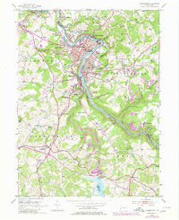
1953 Map of Vandergrift
USGS Topo · Published 1980About this map
The Kiskiminetas River snakes through this industrial landscape, carving a deep valley that separates the clustered borough of Vandergrift from the neighboring hills. This mid-century survey captures the region during a period of heavy industry and resource extraction, evidenced by the extensive Strip Mines and the presence of the Conrail line hugging the riverbank. The planned layout of the borough, with its distinct residential sectors like East Vandergrift and West Vandergrift, contrasts with the rural character of the surrounding township lands.
Find a feature on this map
58 named features on this map. Tap any name to fly to it.
Don’t see what you’re looking for? This feature index may not catch every label — zoom into the map to look around manually.
Map Details
Editions of this 1953 Vandergrift Map
4 editions found
Other maps of this area

1900 · Latrobe
USGS Topo · 1:62,500

1902 · Latrobe
USGS Topo · 1:62,500

1902 · Elders Ridge
USGS Topo · 1:62,500

1903 · Latrobe
USGS Topo · 1:62,500

1904 · Elders Ridge
USGS Topo · 1:62,500

1904 · Greensburg
USGS Topo · 1:62,500

1906 · Greensburg
USGS Topo · 1:62,500

1907 · Freeport
USGS Topo · 1:62,500

1909 · Freeport
USGS Topo · 1:62,500

1953 · Pittsburgh
USGS Topo · 1:250,000