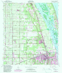
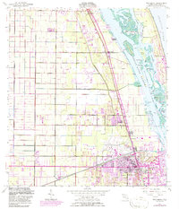
1949 Map of Vero Beach
USGS Topo · Published 1983About this map
Vero Beach and its surrounding citrus and coastal landscapes are documented during a transformative mid-century era, showing a community structured by the Florida East Coast railroad and a grid of agricultural roads. The landscape transitions from the mainland settlements of Gifford and Wabasso across the Indian River Narrows to the barrier islands. The intricate waterways of the Intracoastal Waterway weave around Johns Island and Pine Island, while the mainland reflects post-war growth with the Vero Beach Municipal Airport and emerging residential areas. Notable local landmarks like Copelands Landing and the Drive-in Theater highlight the mix of maritime heritage and mid-century leisure. The presence of numerous canals and the Spoil Bank illustrate the active engineering of the Florida coastline for both navigation and drainage during this period.
Find a feature on this map
54 named features on this map. Tap any name to fly to it.
Don’t see what you’re looking for? This feature index may not catch every label — zoom into the map to look around manually.
Map Details
Editions of this 1949 Vero Beach Map
6 editions found
Other maps of this area

1948 · Riomar
USGS Topo · 1:24,000

1948 · Indrio
USGS Topo · 1:24,000

1949 · Fellsmere
USGS Topo · 1:24,000

1949 · Vero Beach
USGS Topo · 1:24,000

1949 · Sebastian
USGS Topo · 1:24,000

1949 · Oslo
USGS Topo · 1:24,000

1950 · Riomar
USGS Topo · 1:24,000

1950 · Oslo
USGS Topo · 1:24,000

1950 · Indrio
USGS Topo · 1:24,000

1950 · Vero Beach
USGS Topo · 1:24,000