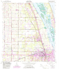
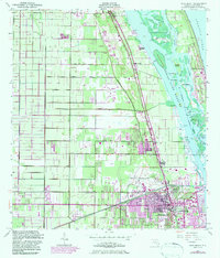
1949 Map of Vero Beach
USGS Topo · Published 1986About this map
Florida East Coast rail lines and the Intracoastal Waterway define the transportation corridor of this coastal Florida segment. Stretching from Wabasso in the north through Winter Beach and Gifford, the map documents the post-war development of Vero Beach before the massive late-20th-century expansion. The landscape is a mix of agricultural utility and coastal recreation, featuring a Fish Hatchery and Landing Strip alongside the emerging citrus and tourism economy.
Find a feature on this map
43 named features on this map. Tap any name to fly to it.
Don’t see what you’re looking for? This feature index may not catch every label — zoom into the map to look around manually.
Map Details
Editions of this 1949 Vero Beach Map
6 editions found
Other maps of this area

1948 · Riomar
USGS Topo · 1:24,000

1948 · Indrio
USGS Topo · 1:24,000

1949 · Fellsmere
USGS Topo · 1:24,000

1949 · Vero Beach
USGS Topo · 1:24,000

1949 · Sebastian
USGS Topo · 1:24,000

1949 · Oslo
USGS Topo · 1:24,000

1950 · Riomar
USGS Topo · 1:24,000

1950 · Oslo
USGS Topo · 1:24,000

1950 · Indrio
USGS Topo · 1:24,000

1950 · Vero Beach
USGS Topo · 1:24,000