1960 Map of Ville Platte
USGS Topo · Published 1964About this map
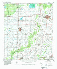
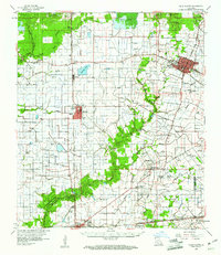
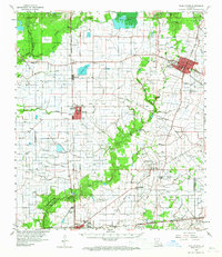
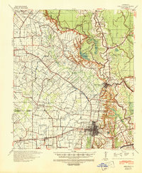
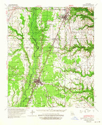
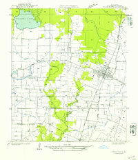
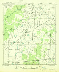
Ville Platte serves as the focal point of this 1960 survey, showcasing the organized grid of the parish seat alongside its Stephens High School and early mid-century infrastructure like the Radio Tower (KVPI). The landscape is a complex network of agricultural irrigation and industry, defined by numerous flumes feeding rice fields and the active Mamou Oil Field. This era represents a peak for the regional rail-and-road economy, with the Chicago Rock Island and Pacific and Missouri Pacific lines connecting the centers of Mamou and Eunice. Local genealogy is well-preserved through numerous family-named landmarks, including the Rougeau Cem, Fontenot Cem, and Guillory Cem. The terrain is shaped by the winding Nezpique Bayou and the expansive Millers Lake, illustrating the Cajun prairie's reliance on these water systems for both drainage and resource extraction during the post-war period.
Find a feature on this map
76 named features on this map. Tap any name to fly to it.
Don’t see what you’re looking for? This feature index may not catch every label — zoom into the map to look around manually.
Map Details
Editions of this 1960 Ville Platte Map
3 editions found
Other maps of this area

1935 · Beaver
USGS Topo · 1:31,680
1935 · Turkey Creek
USGS Topo · 1:62,500
1939 · Opelousas
USGS Topo · 1:62,500
1942 · Oakdale
USGS Topo · 1:62,500
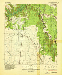
1947 · Ville Platte
USGS Topo · 1:31,680

1947 · Fruge Lake
USGS Topo · 1:31,680

1947 · Redland
USGS Topo · 1:31,680
1947 · Chataignier
USGS Topo · 1:31,680

1947 · Bond
USGS Topo · 1:31,680

1947 · Eunice
USGS Topo · 1:31,680