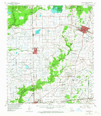
1960 Map of Ville Platte
USGS Topo · Published 1967About this map
The Mamou Oil Field and the Ville Platte Oil and Gas Field dominate the industrial landscape of this Evangeline Parish region during the early 1960s. The settlement pattern is defined by a dense network of bayous, including Nezpique Bayou and Bayou des Cannes, which dictate the placement of early homesteads and cemeteries. Genealogists will find a significant concentration of family-named landmarks such as Platin Cem, Ardoin Cem, and Guillory Cem. The transition from rural agriculture to early 20th-century modernization is evident in the presence of Celestine High Sch in Mamou and Stephens High Sch in the parish seat. Transportation infrastructure is anchored by the Chicago Rock Island and Pacific RR and the Texas and Pacific RR, which connect the commercial hubs of Ville Platte and Eunice to the surrounding prairie settlements.
Find a feature on this map
66 named features on this map. Tap any name to fly to it.
Don’t see what you’re looking for? This feature index may not catch every label — zoom into the map to look around manually.
Map Details
Editions of this 1960 Ville Platte Map
3 editions found
Other maps of this area

1935 · Beaver
USGS Topo · 1:31,680

1935 · Turkey Creek
USGS Topo · 1:62,500

1939 · Opelousas
USGS Topo · 1:62,500

1942 · Oakdale
USGS Topo · 1:62,500

1947 · Ville Platte
USGS Topo · 1:31,680

1947 · Fruge Lake
USGS Topo · 1:31,680

1947 · Redland
USGS Topo · 1:31,680

1947 · Chataignier
USGS Topo · 1:31,680

1947 · Bond
USGS Topo · 1:31,680

1947 · Eunice
USGS Topo · 1:31,680