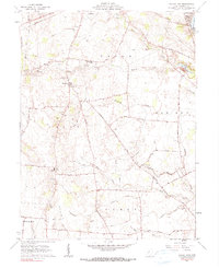
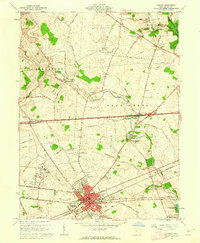
1961 Map of Walnut Run
USGS Topo · Published 1991About this map
Family-named cemeteries and rural school sites dot this landscape south of London, Ohio, in a region defined by the headwaters of Walnut Run and Oak Run. The map highlights the social geography of the early 1960s, documenting the transition between the Old Madison Sch and the Madison High Sch near the northeastern corner. This area lies entirely within the Virginia Military District, a historical survey tract that resulted in the irregular property lines and field boundaries traced here by fine red dashed lines. Settled pockets like Newport are surrounded by a dense network of country roads, including the Old Xenia Road and Yankeetown Road. In the northeast, the Madison Lake State Reserve centers on the waters of Madison Lake, while numerous family burial grounds such as the Sifrit Cem, Old Johnston Cem, and Shepherd Cem offer critical data for local genealogists.
Find a feature on this map
53 named features on this map. Tap any name to fly to it.
Don’t see what you’re looking for? This feature index may not catch every label — zoom into the map to look around manually.
Map Details
Editions of this 1961 Walnut Run Map
2 editions found
Other maps of this area

1906 · Mt Sterling
USGS Topo · 1:62,500

1907 · London
USGS Topo · 1:62,500

1907 · South Charleston
USGS Topo · 1:62,500

1916 · Octa
USGS Topo · 1:62,500

1944 · Octa
USGS Topo · 1:62,500

1947 · Columbus
USGS Topo · 1:250,000

1961 · Columbus
USGS Topo · 1:250,000
1961 · Vienna
USGS Topo · 1:24,000
1961 · West Jefferson
USGS Topo · 1:24,000
1961 · London
USGS Topo · 1:24,000