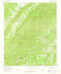
1958 Map of Wattsville
USGS Topo · Published 1973About this map
Backbone Mountain and Savages Mountain dominate this section of St. Clair County, where the industrial history of Alabama is etched into the landscape through numerous strip mines and gravel pits. The community of Coal City serves as a focal point for local history, featuring the Coal City Sch and proximity to several family and community burial grounds, including the Broken Arrow Cem. Transport and topography are deeply linked here, evidenced by the Hardwick Tunnel which allowed the Seaboard Coast Line Railroad to pierce through the high ridges.
Find a feature on this map
56 named features on this map. Tap any name to fly to it.
Don’t see what you’re looking for? This feature index may not catch every label — zoom into the map to look around manually.
Map Details
Editions of this 1958 Wattsville Map
4 editions found
Other maps of this area

1889 · Springville
USGS Topo · 1:125,000

1892 · Springville
USGS Topo · 1:125,000

1947 · Cox Gap
USGS Topo · 1:24,000

1947 · Ragland
USGS Topo · 1:62,500

1947 · Ragland
USGS Topo · 1:24,000

1947 · Riverside
USGS Topo · 1:24,000

1947 · Steele
USGS Topo · 1:62,500

1953 · Birmingham
USGS Topo · 1:250,000

1956 · Birmingham
USGS Topo · 1:250,000

1957 · Birmingham
USGS Topo · 1:250,000