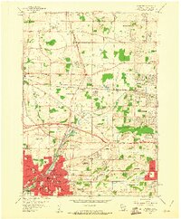
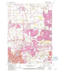
1959 Map of Waukesha
USGS Topo · Published 1961About this map
The Fox River meanders through a landscape defined by rapid mid-century expansion and deep-seated institutional history. In the city of Waukesha, the concentration of civic life is evident at the Carroll College campus and the Wisconsin Industrial School, while the historic significance of local mineral water is preserved at Bethesda Spring Park and White Rock Spring. The surrounding countryside of Pewaukee and Brookfield shows the imprint of industry and transit, with numerous Gravel Pits and Quarries dotting the terrain. Three major rail lines, including the Chicago Milwaukee St Paul and Pacific, converge near Duplainville, illustrating the area's role as a vital transportation junction. Small rural centers like Goerkes Corner and Calhoun maintain their identities even as suburban residential blocks begin to fill the spaces between historic crossroads schools like Hillside School and Sunnyslope School.
Find a feature on this map
78 named features on this map. Tap any name to fly to it.
Don’t see what you’re looking for? This feature index may not catch every label — zoom into the map to look around manually.
Map Details
Editions of this 1959 Waukesha Map
5 editions found
Other maps of this area

1891 · Muskego
USGS Topo · 1:62,500

1892 · Waukesha
USGS Topo · 1:62,500

1892 · Oconomowoc
USGS Topo · 1:62,500

1892 · Eagle
USGS Topo · 1:62,500

1894 · Eagle
USGS Topo · 1:62,500

1897 · Eagle
USGS Topo · 1:62,500

1901 · Waukesha
USGS Topo · 1:62,500

1901 · Muskego
USGS Topo · 1:62,500

1906 · Eagle
USGS Topo · 1:62,500

1906 · Waukesha
USGS Topo · 1:62,500