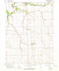
1964 Map of Wellington
USGS Topo · Published 1965About this map
Wellington sits as a central hub in this mid-1960s agricultural portrait of Iroquois County, where the iron rails and local waterways dictate the layout of the land. The Chicago and Eastern Illinois railroad runs vertically through the landscape, passing through Milford in the north and the smaller siding of Alonzo. To the west of the main line, a remnant of former transit is visible in the Old Railroad Grade, providing a look at a changing transportation network.
Find a feature on this map
15 named features on this map. Tap any name to fly to it.
Don’t see what you’re looking for? This feature index may not catch every label — zoom into the map to look around manually.
Map Details
Editions of this 1964 Wellington Map
2 editions found
Other maps of this area

1933 · Hoopeston
USGS Topo · 1:48,000

1936 · Potomac
USGS Topo · 1:62,500

1938 · Milford
USGS Topo · 1:48,000

1938 · Hoopeston
USGS Topo · 1:62,500

1939 · Cissna Park
USGS Topo · 1:62,500

1944 · Milford
USGS Topo · 1:62,500

1949 · Cissna Park
USGS Topo · 1:62,500

1953 · Danville
USGS Topo · 1:250,000

1955 · Danville
USGS Topo · 1:250,000

1956 · Danville
USGS Topo · 1:250,000