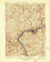
1944 Map of Wellsville
USGS Topo · Published 1944About this map
The Ohio River serves as the industrial and geographic spine of this tri-state region, where the borders of Ohio, West Virginia, and Pennsylvania meet. In the mid-1940s, East Liverpool and Wellsville stand as the primary hubs of activity, their growth tied closely to the heavy rail presence of the Pennsylvania RR and the P C C & ST L RR. These transportation corridors follow the river's curve, connecting manufacturing centers with smaller settlements like New Somerset and Empire.
Find a feature on this map
96 named features on this map. Tap any name to fly to it.
Don’t see what you’re looking for? This feature index may not catch every label — zoom into the map to look around manually.
Map Details
Editions of this 1944 Wellsville Map
2 editions found

Other maps of this area

1901 · Cadiz
USGS Topo · 1:62,500

1901 · Beaver
USGS Topo · 1:62,500

1902 · New Castle
USGS Topo · 1:62,500

1903 · Cadiz
USGS Topo · 1:62,500

1904 · Newcastle
USGS Topo · 1:62,500

1904 · Wellsville
USGS Topo · 1:62,500

1904 · Steubenville
USGS Topo · 1:62,500

1904 · Beaver
USGS Topo · 1:62,500

1904 · Burgettstown
USGS Topo · 1:62,500

1905 · Salineville
USGS Topo · 1:62,500