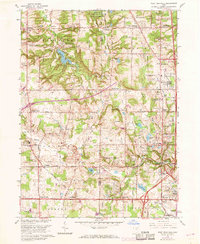
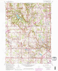
1963 Map of West Richfield
USGS Topo · Published 1968About this map
The Cleveland Ordnance Plant and the expansive Hinckley Reservation dominate the northern landscape of this topographic study, where the rolling terrain of the Connecticut Western Reserve meets the developing suburban fringes of Northeast Ohio. Water defines much of the land use, from the recreation-centered Hinckley Lake and Granger Lake to the meandering East Branch Rocky River. Small clusters like West Richfield, Ghent, and Granger serve as anchors for a network of cemeteries and local institutions, including the Hinckley Ridge Cemetery and Highland High School.
Find a feature on this map
79 named features on this map. Tap any name to fly to it.
Don’t see what you’re looking for? This feature index may not catch every label — zoom into the map to look around manually.
Map Details
Editions of this 1963 West Richfield Map
5 editions found
Other maps of this area

1902 · Berea
USGS Topo · 1:62,500

1903 · Cleveland
USGS Topo · 1:62,500

1903 · Akron
USGS Topo · 1:62,500

1904 · Berea
USGS Topo · 1:62,500

1904 · Medina
USGS Topo · 1:62,500

1905 · Akron
USGS Topo · 1:62,500

1906 · Medina
USGS Topo · 1:62,500

1950 · Cleveland
USGS Topo · 1:250,000

1953 · Broadview Heights
USGS Topo · 1:24,000

1953 · Berea
USGS Topo · 1:24,000