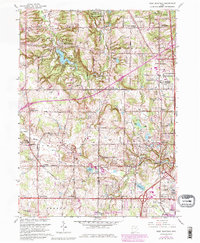
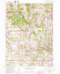
1963 Map of West Richfield
USGS Topo · Published 1980About this map
The Cleveland Ordnance Plant occupies the northern edge of this landscape, a stark institutional presence just north of the recreational grounds of the Hinckley Reservation. This area near the Medina and Summit County line shows a transition from rural agricultural plots to suburban expansion, particularly visible in the purple revisions around Richfield Heights and Fairlawn. Numerous Oil Wells and Gas Wells are scattered throughout the hills of Hinckley and Granger, indicating an active mineral economy alongside traditional farming. Settlement is anchored by small community nodes such as West Richfield, Bath Center, and Ghent. Local history is deeply etched into the terrain through landmarks like the Hinckley Ridge Church, Morris Chapel, and family-named cemeteries such as Ganyard Cemetery and Beach Cemetery, which serve as vital markers for genealogical research in this part of the Connecticut Western Reserve.
Find a feature on this map
69 named features on this map. Tap any name to fly to it.
Don’t see what you’re looking for? This feature index may not catch every label — zoom into the map to look around manually.
Map Details
Editions of this 1963 West Richfield Map
5 editions found
Other maps of this area

1902 · Berea
USGS Topo · 1:62,500

1903 · Cleveland
USGS Topo · 1:62,500

1903 · Akron
USGS Topo · 1:62,500

1904 · Berea
USGS Topo · 1:62,500

1904 · Medina
USGS Topo · 1:62,500

1905 · Akron
USGS Topo · 1:62,500

1906 · Medina
USGS Topo · 1:62,500

1950 · Cleveland
USGS Topo · 1:250,000

1953 · Broadview Heights
USGS Topo · 1:24,000

1953 · Berea
USGS Topo · 1:24,000