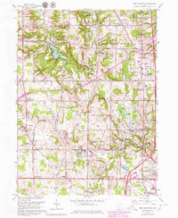
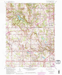
1963 Map of West Richfield
USGS Topo · Published 1980About this map
Hinckley Reservation and the sprawling Cleveland Ordnance Plant dominate the northern landscape of this 1963 survey, illustrating the tension between regional recreation and Cold War military infrastructure. The map reveals a cluster of rural communities along the Medina and Summit county line, including West Richfield, Hinckley, and Ghent. This era shows the suburban expansion of Akron and Cleveland pushing into traditional farmland, marked by new developments around Fairlawn and Montrose.
Find a feature on this map
77 named features on this map. Tap any name to fly to it.
Don’t see what you’re looking for? This feature index may not catch every label — zoom into the map to look around manually.
Map Details
Editions of this 1963 West Richfield Map
5 editions found
Other maps of this area

1902 · Berea
USGS Topo · 1:62,500

1903 · Cleveland
USGS Topo · 1:62,500

1903 · Akron
USGS Topo · 1:62,500

1904 · Berea
USGS Topo · 1:62,500

1904 · Medina
USGS Topo · 1:62,500

1905 · Akron
USGS Topo · 1:62,500

1906 · Medina
USGS Topo · 1:62,500

1950 · Cleveland
USGS Topo · 1:250,000

1953 · Broadview Heights
USGS Topo · 1:24,000

1953 · Berea
USGS Topo · 1:24,000