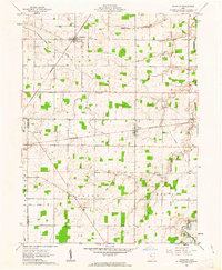
1961 Map of Wharton
USGS Topo · Published 1963About this map
The agricultural plains of Wyandot County are defined on this sheet by the diagonal line of the Old Indian Treaty Boundary, which cuts across the townships of Salem and Mifflin. This line marks a significant historical division in the landscape, contrasting with the regular grid of farm fields and sections established in Richland and Jackson. The settlement of Wharton serves as a local hub at the intersection of the Central and New York railroad lines, while Kirby anchors the eastern side of the map along the Pennsylvania tracks.
Find a feature on this map
33 named features on this map. Tap any name to fly to it.
Don’t see what you’re looking for? This feature index may not catch every label — zoom into the map to look around manually.
Map Details
Editions of this 1961 Wharton Map
2 editions found
Other maps of this area

1905 · Arlington
USGS Topo · 1:62,500

1907 · Arlington
USGS Topo · 1:24,000

1907 · Upper Sandusky
USGS Topo · 1:62,500

1915 · Kenton
USGS Topo · 1:62,500

1915 · La Rue
USGS Topo · 1:62,500

1944 · Kenton
USGS Topo · 1:62,500

1950 · Marion
USGS Topo · 1:250,000

1960 · Upper Sandusky
USGS Topo · 1:24,000

1960 · Mt Blanchard
USGS Topo · 1:24,000

1960 · Marseilles
USGS Topo · 1:24,000