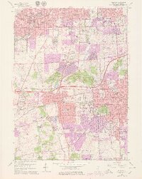
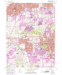
1962 Map of Wheaton
USGS Topo · Published 1979About this map
Wheaton and Glen Ellyn center this mid-century portrait of suburban DuPage County, showing a landscape rapidly transitioning from its agricultural roots toward dense residential growth. The Morton Arboretum provides a significant green space amidst the expanding street grids of Downers Grove and Lisle. This era is marked by institutional prominence, with the campuses of Wheaton College, Maryknoll Seminary, and the National College of Chiropractic established as major local landmarks.
Find a feature on this map
106 named features on this map. Tap any name to fly to it.
Don’t see what you’re looking for? This feature index may not catch every label — zoom into the map to look around manually.
Map Details
Editions of this 1962 Wheaton Map
5 editions found
Other maps of this area

1890 · Des Plaines
USGS Topo · 1:62,500

1891 · Riverside
USGS Topo · 1:62,500

1892 · Joliet
USGS Topo · 1:62,500

1893 · Riverside
USGS Topo · 1:62,500

1894 · Des Plaines
USGS Topo · 1:62,500

1900 · Des Plaines
USGS Topo · 1:62,500

1900 · Riverside
USGS Topo · 1:62,500

1901 · Des Plaines
USGS Topo · 1:62,500

1901 · Riverside
USGS Topo · 1:62,500

1908 · Wheaton
USGS Topo · 1:62,500