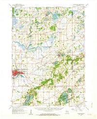
1960 Map of Whitewater
USGS Topo · Published 1963About this map
Glacial geology dictates the landscape across this portion of Jefferson and Walworth counties, where the Kettle Moraine State Forest preserves the complex terrain of ridges and depressions characteristic of the region. The city of Whitewater serves as a primary hub, situated near Tripp Lake and Cravath Lake, while the village of Palmyra sits further northeast, adjacent to the Palmyra Airport and the waters of Blue Spring Lake. The area is densely populated with small rural institutions, including the Siloam Chapel Cem, Corner Grove Sch, and the Wright Mill Sch, which highlight the decentralized network of 20th-century agriculture.
Find a feature on this map
96 named features on this map. Tap any name to fly to it.
Don’t see what you’re looking for? This feature index may not catch every label — zoom into the map to look around manually.
Map Details
Editions of this 1960 Whitewater Map
4 editions found
Other maps of this area

1891 · Waterloo
USGS Topo · 1:62,500

1891 · Koshkonong
USGS Topo · 1:62,500

1892 · Watertown
USGS Topo · 1:62,500

1892 · Oconomowoc
USGS Topo · 1:62,500

1892 · Whitewater
USGS Topo · 1:62,500

1892 · Eagle
USGS Topo · 1:62,500

1893 · Delavan
USGS Topo · 1:62,500

1893 · Whitewater
USGS Topo · 1:62,500

1893 · Shopiere
USGS Topo · 1:62,500

1893 · Geneva
USGS Topo · 1:62,500