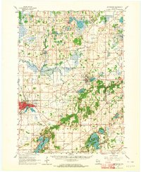
1960 Map of Whitewater
USGS Topo · Published 1964About this map
Wisconsin State College anchors the city of Whitewater, where the city limits cross the border between Jefferson and Walworth counties. This landscape is defined by the glacial hydrology of the Kettle Moraine State Forest, characterized by an intricate network of kettle lakes, ponds, and marshlands. The Scuppernong River and Bark River wind through the northern sections, powering early industry at Heath Mills and sustaining the Fish Hatchery near Palmyra.
Find a feature on this map
75 named features on this map. Tap any name to fly to it.
Don’t see what you’re looking for? This feature index may not catch every label — zoom into the map to look around manually.
Map Details
Editions of this 1960 Whitewater Map
4 editions found
Other maps of this area

1891 · Waterloo
USGS Topo · 1:62,500

1891 · Koshkonong
USGS Topo · 1:62,500

1892 · Watertown
USGS Topo · 1:62,500

1892 · Oconomowoc
USGS Topo · 1:62,500

1892 · Whitewater
USGS Topo · 1:62,500

1892 · Eagle
USGS Topo · 1:62,500

1893 · Delavan
USGS Topo · 1:62,500

1893 · Whitewater
USGS Topo · 1:62,500

1893 · Shopiere
USGS Topo · 1:62,500

1893 · Geneva
USGS Topo · 1:62,500