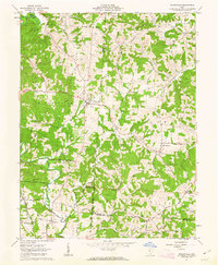
1961 Map of Wilkesville
USGS Topo · Published 1963About this map
Wilkesville serves as the focal point for this rural Ohio landscape, where the confluence of Vinton, Meigs, and Gallia counties meets. The terrain is defined by a dense network of streams such as Raccoon Creek, Flatlick Run, and Strongs Run that carve through the timbered hills of the Wayne National Forest. Notable for its genealogical value, the map documents numerous family-named landmarks and rural congregations, including Fair Play Ch, Pine Grove Ch, and the Mt Olive Cem. Land boundaries here reflect the deep history of the Ohio Company Purchase, with original land lines and subdivisions clearly marked across the townships of Wilkesville, Salem, and Huntington. Small settlements like Ewington, Salem Center, and Alice are connected by narrow roads such as Adney Road and Smith Road, illustrating a mid-century agricultural and forest-based economy.
Find a feature on this map
52 named features on this map. Tap any name to fly to it.
Don’t see what you’re looking for? This feature index may not catch every label — zoom into the map to look around manually.
Map Details
Editions of this 1961 Wilkesville Map
4 editions found
Other maps of this area

1905 · Wilkesville
USGS Topo · 1:62,500

1906 · Bidwell
USGS Topo · 1:62,500

1907 · Pomeroy
USGS Topo · 1:62,500

1908 · Bidwell
USGS Topo · 1:62,500

1908 · Point Pleasant
USGS Topo · 1:62,500

1908 · Wilkesville
USGS Topo · 1:62,500

1926 · Point Pleasant
USGS Topo · 1:62,500

1929 · Point Pleasant
USGS Topo · 1:62,500

1947 · Columbus
USGS Topo · 1:250,000

1957 · Huntington
USGS Topo · 1:250,000