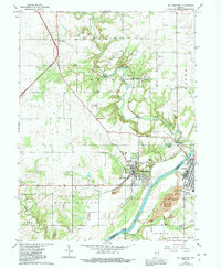
1962 Map of Williamsport
USGS Topo · Published 1992About this map
Big Pine Creek carves a winding path through this portion of Warren County, where the transition from prairie to river valley is marked by distinctive terrain features like Hog Back Hill and the lookout at Lovers Leap. The landscape reflects a legacy of small-scale industry and community life, anchored by the settlement of Williamsport and the presence of the historic Mudlavia Springs health resort site. Infrastructure of the early 1960s, such as the Norfolk and Western railroad and the Paul Presser Bridge, connects the scattered townships of Liberty and Washington.
Find a feature on this map
54 named features on this map. Tap any name to fly to it.
Don’t see what you’re looking for? This feature index may not catch every label — zoom into the map to look around manually.
Map Details
Editions of this 1962 Williamsport Map
3 editions found
Other maps of this area

1953 · Danville
USGS Topo · 1:250,000

1955 · Danville
USGS Topo · 1:250,000

1956 · Danville
USGS Topo · 1:250,000

1958 · Stonebluff
USGS Topo · 1:24,000
1958 · Covington
USGS Topo · 1:24,000

1961 · Chatterton
USGS Topo · 1:24,000

1961 · Tab
USGS Topo · 1:24,000

1961 · Pine Village
USGS Topo · 1:24,000

1961 · West Lebanon
USGS Topo · 1:24,000

1962 · Williamsport
USGS Topo · 1:24,000