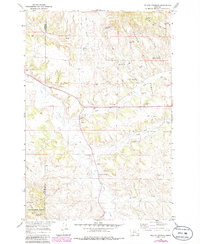
1966 Map of Willow Crossing
USGS Topo · Published 1986About this map
The boundary between Rosebud Co Powder River Co runs through this landscape within the Custer National Forest, where high plains ranching and resource extraction define the local economy. The settlement of Willow Crossing serves as a small hub near the Willow Crossing Cem, situated along the winding course of Otter Creek. Evidence of mid-century industrial activity and land management is visible through features like the Coal Creek Mine and numerous water developments including the Coal Creek Well and Lower Coal Creek Reservoir. Small-scale infrastructure such as the Jeep Trail and the Stevens Landing Area highlights how this remote Montana terrain was navigated for both work and recreation, while the Red Shale Campground points to the area's utility for Forest Service visitors.
Find a feature on this map
29 named features on this map. Tap any name to fly to it.
Don’t see what you’re looking for? This feature index may not catch every label — zoom into the map to look around manually.
Map Details
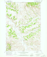
Editions of this 1966 Willow Crossing Map
3 editions found
Other maps of this area

1954 · Hardin
USGS Topo · 1:250,000

1957 · Hardin
USGS Topo · 1:250,000

1958 · Hardin
USGS Topo · 1:250,000

1966 · Coleman Draw
USGS Topo · 1:24,000

1966 · Ashland
USGS Topo · 1:24,000

1966 · Beaver Creek School
USGS Topo · 1:24,000

1966 · Cook Creek Reservoir
USGS Topo · 1:24,000

1966 · King Mountain
USGS Topo · 1:24,000

1966 · Willow Crossing
USGS Topo · 1:24,000

1966 · Ashland NE
USGS Topo · 1:24,000