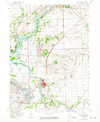
1954 Map of Wilmington
USGS Topo · Published 1965About this map
Wilmington sits at the heart of this mid-century landscape, positioned where the Kankakee River meets a complex network of industrial and conservation lands. The map illustrates a region defined by major infrastructure, from the massive footprint of the Joliet Arsenal to the Des Plaines Wildlife Conservation Area along the Des Plaines River. These federal and state holdings dominate the center of the sheet, interspersed with small settlements and vital transit hubs like Elwood and Channahon.
Find a feature on this map
78 named features on this map. Tap any name to fly to it.
Don’t see what you’re looking for? This feature index may not catch every label — zoom into the map to look around manually.
Map Details
Editions of this 1954 Wilmington Map
3 editions found
Other maps of this area

1890 · Des Plaines
USGS Topo · 1:62,500

1892 · Morris
USGS Topo · 1:62,500

1892 · Joliet
USGS Topo · 1:62,500

1892 · Wilmington
USGS Topo · 1:62,500

1894 · Des Plaines
USGS Topo · 1:62,500

1900 · Des Plaines
USGS Topo · 1:62,500

1901 · Des Plaines
USGS Topo · 1:62,500

1918 · Wilmington
USGS Topo · 1:62,500

1918 · Morris
USGS Topo · 1:62,500

1922 · Kankakee
USGS Topo · 1:62,500