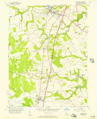
1956 Map of Wyoming
USGS Topo · Published 1957About this map
The town of Wyoming and the neighboring community of Camden anchor the northern landscape of Kent County in the mid-1950s. The region is defined by its small-town hubs and a dense network of watercourses that powered early industry, including the Voshell Mill on Tidbury Creek and the Lexington Mill downstream on the Pratt Branch. The Pennsylvania railroad line serves as a central spine for the agricultural economy, connecting the hamlets of Woodside, Viola, and Felton.
Find a feature on this map
56 named features on this map. Tap any name to fly to it.
Don’t see what you’re looking for? This feature index may not catch every label — zoom into the map to look around manually.
Map Details
Editions of this 1956 Wyoming Map
3 editions found
Other maps of this area

1899 · Vineland
USGS Topo · 1:125,000

1899 · Dover
USGS Topo · 1:125,000

1906 · Dover
USGS Topo · 1:125,000

1918 · Cedar Creek
USGS Topo · 1:62,500

1918 · Harrington
USGS Topo · 1:62,500

1919 · Cedar Creek
USGS Topo · 1:62,500

1919 · Vineland
USGS Topo · 1:125,000

1920 · Dover
USGS Topo · 1:125,000

1926 · Wyoming
USGS Topo · 1:48,000

1930 · Wyoming
USGS Topo · 1:62,500