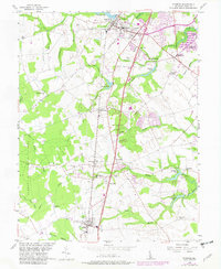
1956 Map of Wyoming
USGS Topo · Published 1982About this map
Central Kent County reveals a landscape of agricultural tradition and small railroad-aligned villages along the Conrail line. The twin towns of Wyoming and Camden anchor the northern section, surrounded by an intricate drainage system including Isaac Branch and Tidbury Creek. This survey captures a moment of transition as postwar housing expansion, such as the Dover AFB Housing Annex, begins to appear alongside established rural landmarks like Voshell Mill and Odd Fellows Cem.
Find a feature on this map
50 named features on this map. Tap any name to fly to it.
Don’t see what you’re looking for? This feature index may not catch every label — zoom into the map to look around manually.
Map Details
Editions of this 1956 Wyoming Map
3 editions found
Other maps of this area

1899 · Vineland
USGS Topo · 1:125,000

1899 · Dover
USGS Topo · 1:125,000

1906 · Dover
USGS Topo · 1:125,000

1918 · Cedar Creek
USGS Topo · 1:62,500

1918 · Harrington
USGS Topo · 1:62,500

1919 · Cedar Creek
USGS Topo · 1:62,500

1919 · Vineland
USGS Topo · 1:125,000

1920 · Dover
USGS Topo · 1:125,000

1926 · Wyoming
USGS Topo · 1:48,000

1930 · Wyoming
USGS Topo · 1:62,500