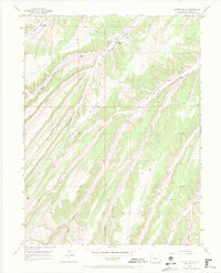
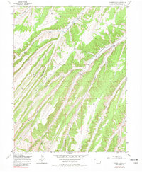
1952 Map of Yankee Gulch
USGS Topo · Published 1969About this map
High-desert ranching and early energy exploration define this 1952 topographic study of the Piceance Basin. Established homesteads like Reigle Ranch and Duckett Ranch occupy the drainages, supported by complex irrigation systems including several unnamed ditches that follow the contours of the drainage floor. The landscape is a network of deeply incised canyons and gulches, with Yankee Gulch and Ryan Gulch serving as primary geographic markers.
Find a feature on this map
21 named features on this map. Tap any name to fly to it.
Don’t see what you’re looking for? This feature index may not catch every label — zoom into the map to look around manually.
Map Details
Editions of this 1952 Yankee Gulch Map
6 editions found
Other maps of this area

1929 · Highmore
USGS Topo · 1:62,500

1952 · Wolf Ridge
USGS Topo · 1:24,000

1952 · Yankee Gulch
USGS Topo · 1:24,000

1952 · Rock School
USGS Topo · 1:24,000

1952 · Square S Ranch
USGS Topo · 1:24,000

1956 · Grand Junction
USGS Topo · 1:250,000

1959 · Grand Junction
USGS Topo · 1:250,000

1960 · Grand Junction
USGS Topo · 1:250,000

1962 · Grand Junction
USGS Topo · 1:250,000

1964 · Grand Junction
USGS Topo · 1:250,000