1990s Maps of Fairbanks North Star, Alaska
Explore 22 historic maps of Fairbanks North Star from the 1990s. These maps offer a rare glimpse into what life looked like during the 1990s — showing old roads, neighborhoods, homes, and landmarks that have changed or disappeared over time.
Whether you're researching your family's past, planning a metal detecting trip, or studying how Fairbanks North Star's landscape evolved across the 1990s, these high-resolution maps are a powerful tool for exploring the history of this region.
- Focus on a specific era: All maps on this page are from the 1990s, giving you a focused view of this time period.
- See what’s changed: Compare century-old streets, trails, and buildings to today's modern landscape using overlays and satellite layers.
- Research with precision: Use these maps for genealogy, historical research, land use analysis, or educational projects.
- View, download, or print: Maps are fully viewable online in high resolution, and can be downloaded or printed for your own records.
Start exploring Fairbanks North Star's history through authentic maps from the 1990s. This is your window into the past.
Fairbanks North Star, AK maps
(22)- 1992 Map of Fairbanks D-1 NE
 1992 Fairbanks D-1 NE1992 Print · USGSAlaska's interior wilderness near Fairbanks was still largely defined by seasonal access and mining prospects in the early nineties. You can trace the Chena Hot Springs Road corridor and locate landmarks like the Two Rivers School and the network of Winter Trails that served remote Cabins.
 - 1992 Map of Fairbanks D-1 SW
 1992 Fairbanks D-1 SW1992 Print · USGSFairbanks North Star Borough comes into focus during the early nineties as residential life and industrial infrastructure expand along the Chena River. Genealogists and historians can trace the development of North Pole, identify local institutions like Badger Road Sch, and follow the route of the Trans-Alaska Pipeline.
 - 1992 Map of Fairbanks D-3 SE
 1992 Fairbanks D-3 SE1992 Print · USGSFairbanks and the gold-bearing hills of the Tanana Valley are captured here in the early nineties, showing a landscape defined by mining and subarctic wilderness. Trace the industrial footprint of Ester and its surrounding Tailings, or locate remote Prospects and the Open Pit Mine along the creek beds.
 - 1992 Map of Big Delta D-6 SW
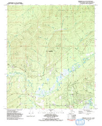
 1992 Big Delta D-6 SW1992 Print · USGSInterior Alaska during the early nineties reveals a landscape shared by defense training and public recreation along the Chena River. Map collectors can trace the Winter Trail through the Fort Wainwright maneuver lands and find isolated Cabins near the water.
 - 1992 Map of Fairbanks D-3 SW
 1992 Fairbanks D-3 SW1992 Print · USGSFairbanks and its western reaches appear in the early 1990s as a hub of military, academic, and aviation activity. Researchers can trace the layout of the University of Alaska, the extensive grounds of Fort Wainwright Military Reservation, and neighborhood growth in Aurora.
 - 1992 Map of Big Delta C-6 SW
 1992 Big Delta C-6 SW1992 Print · USGSAlaska's Interior during the 1990s showcases a landscape of military readiness and massive energy infrastructure. Researchers can trace the path of the Trans-Alaska Pipeline near Pumping Station No. 8 and the wetlands along the Little Salcha River.
 - 1992 Map of Fairbanks D-2 NW
 1992 Fairbanks D-2 NW1992 Print · USGSThe Fairbanks outskirts in the early nineties show a landscape defined by mining prospects, research sites, and the winding Goldstream Creek. Trace local history through the Old Railroad Grade, the Northern Lights Memorial Cem, and the settlement of Dogpatch.2 unique versions available
 - 1992 Map of Fairbanks C-1 NE
 1992 Fairbanks C-1 NE1992 Print · USGSIn the early nineties, the Tanana River valley was defined by its massive military installations and the vital path of the Trans-Alaska Pipeline. Researchers can trace the layout of Eielson Air Force Base, find local Gravel Pits, and locate schools like the High Sch and Pennel Sch.2 unique versions available
 - 1992 Map of Big Delta C-6 NW
 1992 Big Delta C-6 NW1992 Print · USGSThe Alaska interior in the early 1990s reveals a landscape defined by strategic defense and energy infrastructure. Trace the path of the Trans-Alaska Pipeline and explore the vast training grounds of the Fort Wainwright Maneuver Area.
 - 1992 Map of Livengood A-2 SE
 1992 Livengood A-2 SE1992 Print · USGSThe Fairbanks North Star region is shown in the early nineties, illustrating a landscape shaped by gold mining and energy transport. Researchers can locate historic mining camps at Old Chatanika and Olnes, or trace the path of the Davidson Ditch and the Trans-Alaska Pipeline.
 - 1992 Map of Big Delta D-6 NW
 1992 Big Delta D-6 NW1992 Print · USGSThe Fairbanks North Star Borough in the early nineties remained a wilderness of river valleys and seasonal paths. Researchers can trace the development of the Chena River State Recreation Area and historical access routes like the Winter Trail and Pack Trail.
 - 1992 Map of Livengood A-1 SE
 1992 Livengood A-1 SE1992 Print · USGSThe gold-bearing drainages north of Fairbanks are shown in the early nineties, revealing a landscape defined by industrial placer mining and scientific research. Trace the history of regional claims through Fairbanks Creek Camp, the Meehan (Site), and the specialized Eielson Research Site.
 - 1992 Map of Fairbanks D-2 NE
 1992 Fairbanks D-2 NE1992 Print · USGSNorth of Fairbanks in the early nineties, this survey documents a landscape defined by gold mining history and modern technology. Trace the legacy of extraction through Fox and tailings piles, or locate specialized sites like the NASA Data Acquisition Facility.
 - 1992 Map of Fairbanks D-1 SE
 1992 Fairbanks D-1 SE1992 Print · USGSThe Fairbanks North Star Borough during the early nineties reveals a landscape of managed waterways and military training grounds east of the city. Researchers can trace the Winter Trail network and flood control infrastructure like the Levee and Floodgate near the Chena River.
 - 1992 Map of Fairbanks C-1 NW
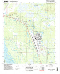
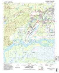
 1992 Fairbanks C-1 NW1992 Print · USGSThe community of North Pole and the Tanana River valley are shown here in the early nineties during a period of significant infrastructure development. Researchers can trace the path of the Trans-Alaska Pipeline past the Refinery and through the Dyke Range Military Reservation.
 - 1992 Map of Fairbanks D-2 SE
 1992 Fairbanks D-2 SE1992 Print · USGSFairbanks and the adjacent military installations are captured here in the early 1990s as the city expanded across the Chena and Tanana river plains. Researchers can trace neighborhood growth in Shannon Park or locate family sites near the Clay St Cem and Birch Hill Cem.
 - 1992 Map of Fairbanks C-1 SE
 1992 Fairbanks C-1 SE1992 Print · USGSThe braided channels of the Tanana River valley meet strategic military outposts in the early nineties southeast of Fairbanks. Researchers can trace cold-climate infrastructure through the Eielson Air Force Base and the specialized Eielson Alaska Long Period Array Research Site.
 - 1992 Map of Fairbanks D-1 NW
 1992 Fairbanks D-1 NW1992 Print · USGSThe Fairbanks North Star Borough in the early nineties serves as a hub for both scientific research and resource extraction. Researchers and geologists can trace the paths of the Trans-Alaska Pipeline and find specific installations like the NASA Data Aquisition Facility.2 unique versions available
 - 1992 Map of Fairbanks D-3 NE
 1992 Fairbanks D-3 NE1992 Print · USGSThe uplands north of Fairbanks appear in the early nineties, centered on the strategic and scientific infrastructure of the Interior. Researchers can trace the layout of the Murphy Dome Air Force Station and find local landmarks like the Ester Dome Observatory and Saulich.
 - 1992 Map of Big Delta B-6 NW
 1992 Big Delta B-6 NW1992 Print · USGSThe Tanana and Salcha rivers converge in this early nineties survey of a popular Alaskan recreation corridor. Trace the development of Harding Lake and its state recreation area, or locate landmarks like Aurora Lodge and the Richardson Highway.
 - 1992 Map of Livengood A-1 SW
 1992 Livengood A-1 SW1992 Print · USGSAlaska's interior mining district is frozen in time during the early nineties, revealing the deep scars and legacy of the gold rush. Trace the complex web of extraction at the Newsboy Mine and McCarty Mine, or locate the site of the vanished Golden City.
 - 1992 Map of Fairbanks D-2 SW
 1992 Fairbanks D-2 SW1992 Print · USGSFairbanks and its neighboring university communities are captured in the early 1990s at the intersection of river transport and rail infrastructure. Researchers can trace the development of College and Broadmoor alongside the Sea Plane Base and the Alaska Railroad.2 unique versions available
End of results
Showing maps 1-22 of 22
Top cities of Fairbanks North Star
Frequently asked questions
- What are the different types of historical maps available for Fairbanks North Star?
- What is the oldest map of Fairbanks North Star?
- Where can I purchase historical maps of Fairbanks North Star for my home or office?
- Where can I download high-res historical maps of Fairbanks North Star?
- Are there historical topographic maps available for Fairbanks North Star?
- Is there historical aerial imagery available for Fairbanks North Star?
- Where are historical maps of Fairbanks North Star sourced from?