Old Maps of Kern County, California for Metal Detecting
Plan your next treasure hunt with 1,139 historic maps of Kern County. Find old homesites, ghost towns, trails, and gathering spots that may be lost to time — perfect for identifying promising metal detecting locations.
- Locate forgotten sites: Uncover places like long-lost settlements, abandoned rail lines, or gathering spots.
- Plan better hunts: Use map overlays combined with LiDAR or satellite views to narrow in on historically rich areas.
- Made for detectorists: Thousands of hobbyists use these maps to discover relics, coins, and hidden history.
Use these historic maps to boost your research and find new opportunities beneath the surface of Kern County.
Kern County, CA maps
(1,139)- 1903 Map of Mt. Pinos
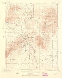
 1903 Mt. Pinos1903 Print · USGSVentura and Kern counties at the start of the century remain largely a wild backcountry of forest reserves and high peaks. Genealogists and historians can trace early outposts like Pattiway, the high-altitude Frazier Borax Mine, and the Pine Mtn Lodge.7 unique versions available
 - 1903 Map of Randsburg
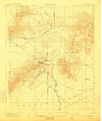
 1903 Randsburg1903 Print · USGSThe Rand Mining District comes to life in this survey of the California desert during the early twentieth-century gold rush. Genealogists and mining historians can trace the early footprints of Randsburg and Johannesburg, the path of the Randsburg R. R., and the locations of the Yellow Aster Mine and Summit Diggings.
 - 1903 Map of Tejon
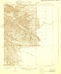
 1903 Tejon1903 Print · USGSThe high passes and desert fringes of the Tehachapis come alive in this survey of the early twentieth-century frontier. Genealogists and historians can trace the foundations of Old Fort Tejon, follow the trail through Tejon Pass, or locate early mining sites like Frazier Mine.7 unique versions available
 - 1906 Map of Bakersfield
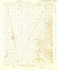
 1906 Bakersfield1906 Print · USGSIn the early 1900s, Bakersfield was the heart of a booming oil and rail network just as the landscape was being transformed. Genealogists and historians can trace early settlements like Oil Center and Jewetta or the industrial workings of the Fullers Earth Mine.5 unique versions available
 - 1906 Map of Kernville, 1955 Print
 1906 Kernville1955 Print · USGSThe Kern River Valley at the turn of the century shows a landscape of mining camps and river settlements before the damming of the river. Genealogists and historians can trace the early locations of Kernville, Isabella, and Weldon, or locate the Big Blue Mine and Bodfish P.O.
 - 1908 Map of Kernville
 1908 Kernville1908 Print · USGSThe southern Sierra Nevada frontier comes to life in this survey of the Kern River Valley at the dawn of the twentieth century. Genealogists and researchers can locate early mining operations at the Big Blue Mine and trace historic settlements like Vaughn Bodfish P.O. and Weldon before mid-century water projects.6 unique versions available
 - 1910 Map of Buena Vista Lake, 1912 Print
 1910 Buena Vista Lake1912 Print · USGSThe southern San Joaquin Valley comes to life in the years before the great lakes were drained for agriculture. Genealogists and historians can trace early rail stops like Bowerbank and Hazelton or locate rural landmarks such as the Palm School and Moron Taft P O.
 - 1911 Map of Randsburg, 1958 Print
 1911 Randsburg1958 Print · USGSHigh desert mining towns in Kern and San Bernardino counties flourished during this era of peak mineral extraction. Genealogists and historians can trace the early footprints of Randsburg and Johannesburg, or locate the Yellow Aster Mine and the rail-side settlement of Atolia.2 unique versions available
 - 1912 Map of Randsburg
 1912 Randsburg1912 Print · USGSThe Rand mining district comes to life in this early century survey of the Kern County desert. Trace the rail lines of the Southern Pacific and the footprint of the massive Yellow Aster Mine near Randsburg and Atolia.3 unique versions available
 - 1912 Map of McKittrick
 1912 McKittrick1912 Print · USGSKern and San Luis Obispo counties are shown here just as the early oil boom and cattle ranching were shaping the desert landscape. Researchers can trace the original Pacific Southern rail lines and find legacy ranch sites like Sandiego Joe's and Temblor Ranch.4 unique versions available
 - 1912 Map of Buena Vista Lake, 1921 Print
 1912 Buena Vista Lake1921 Print · USGSThe San Joaquin Valley at the height of its irrigation and oil boom is captured here, from the streets of Bakersfield to the shores of Buena Vista Lake. Genealogists and local historians can trace early schools like Old River School and the rail stops of the Sunset RR.4 unique versions available
 - 1914 Map of Caliente
 1914 Caliente1914 Print · USGSBakersfield and the southern Joaquin Valley are captured in the early nineteen-teens as the region's rail and oil industries expanded. Genealogists can trace family landmarks like the Tejon Ranch and Rio Bravo Ranch or locate vanished stops such as Woodford Keene P O and Cottonwood Station.7 unique versions available
 - 1914 Map of Lost Hills
 1914 Lost Hills1914 Print · USGSThe western San Joaquin Valley appears here as an arid ranching frontier during the early years of oil exploration. Researchers can trace historic travel routes like the Dudley-Lemoore Road and locate isolated landmarks such as McDonalds Ranch, Emigrant Hill, and Alamo Solo Spr.4 unique versions available
 - 1914 Map of Cholame
 1914 Cholame1914 Print · USGSCentral California ranching and rugged topography meet at the turn of the century across the Temblor Range. Genealogists and historians can trace early outposts like Devils Den, Dudley, and Carter's Ranch.
 - 1915 Map of Elizabeth Lake
 1915 Elizabeth Lake1915 Print · USGSAntelope Valley and the northern reaches of the San Gabriel mountains were transforming in the early twentieth century as major water and rail projects arrived. Genealogists can trace family homesteads such as St Anthony Ranch, old desert outposts like Willow Springs, and early mining sites including the Gray Eagle Mine.2 unique versions available
 - 1915 Map of Searles Lake
 1915 Searles Lake1915 Print · USGSThe Mojave Desert at the height of its early mining boom features a landscape defined by the Trona RR and the thriving gold camps of the Rand Mountains. Genealogists and historians can trace the foundations of Randsburg, the soda works at Trona, and remote outposts like Muerto Leliter PO and Garlock.6 unique versions available
 - 1915 Map of Mojave
 1915 Mojave1915 Print · USGSThe eastern Tehachapi Mountains meet the desert in the early twentieth century as a hub of rail and mining. Trace the historic paths of the Southern Pacific railroad through Tehachapi and Mojave, or locate remote sites like the Joe Walker Mine and Claraville.7 unique versions available
 - 1915 Map of Cholame, 1956 Print
 1915 Cholame1956 Print · USGSThe ranchlands of the Central Coast and western San Joaquin Valley were still largely defined by mining and cattle during the early 1900s. Genealogists and researchers can trace family-run operations at Cholame Ranch or find vanished rural schoolhouses like Eagle School and Alliance School.
 - 1917 Map of Elizabeth Lake
 1917 Elizabeth Lake1917 Print · USGSThe western Antelope Valley and Sierra Pelona appear here during a period of rapid hydraulic and rail expansion. Researchers can trace the original path of the Los Angeles Aqueduct and locate early landmarks like Willow Springs and the Antelope Valley Pumping Sta.6 unique versions available
 - 1917 Map of Cholame
 1917 Cholame1917 Print · USGSSan Luis Obispo and Monterey counties in the early twentieth century reveal a landscape of remote quicksilver mines and isolated ranching outposts. Genealogists and researchers can trace family-named landmarks like Carter's Ranch and early rural education at Eagle School or Choice Valley School.4 unique versions available
 - 1920 Map of Delonagha
 1920 Delonagha1920 Print · USGSThe Sierra Nevada foothills of Kern County come into focus in 1920, showing a landscape defined by the Sequoia National Forest. Researchers can trace the early layout of Glenville, identify remote outposts like Brown Mill, and locate family-named features such as Caughran Springs.
 - 1926 Map of Quincy School
 1926 Quincy School1926 Print · USGSThe foothills of the southern San Joaquin Valley come into focus in the mid-1920s as early infrastructure began to define the rural landscape. Trace the location of the Quincy School and follow the route of the Delano-Woody Road across the White River.2 unique versions available
 - 1926 Map of Glennville
 1926 Glennville1926 Print · USGSKern County's high country is captured here during the 1920s, showing a network of remote ranger stations and early mountain settlements. Genealogists and historians can trace old homestead sites near Havilah, early forestry outposts like Davis RS, and the waters of Delonagha Springs.
 - 1927 Map of McFarland
 1927 McFarland1927 Print · USGSCentral Valley agriculture and transportation converge in the late twenties near the Kern County line. Genealogists and historians can trace the early townsite of McFarland and the settlement of Jasmine along the Southern Pacific rail lines.
 - 1927 Map of Semitropic
 1927 Semitropic1927 Print · USGSRanching and early oil exploration defined this Kern County landscape in the late 1920s. Researchers can locate Indian Burial Mounds and family-named landmarks like Banducci Ranch and the Doheny Gun Club.
Showing maps 1-25 of 1,139
Top cities of Kern County
- Bakersfield historical maps
- Delano historical maps
- Ridgecrest historical maps
- Wasco historical maps
- Shafter historical maps
- Arvin historical maps
See more
Frequently asked questions
- What are the different types of historical maps available for Kern County?
- What is the oldest map of Kern County?
- Where can I purchase historical maps of Kern County for my home or office?
- Where can I download high-res historical maps of Kern County?
- Are there historical topographic maps available for Kern County?
- Is there historical aerial imagery available for Kern County?
- Where are historical maps of Kern County sourced from?